An ABC affiliate in Topeka caught live video of a tornado as it wound its way through Manhattan, Kansas, and onto the Kansas State University campus. It’s dark footage, but the large tornado is visible during many lightening strikes. The video, which captures the on-air meteorologists in complete disbelief, ends when debris from the tornado destroys the station’s skycam.
Archive for the ‘Wild weather’ Category
8 Jun
Sneak attack
Despite dinner outside just an hour ago, we didn’t see this one coming!


This storm brought 60 mph winds and pea-sized hail.

5 Jun
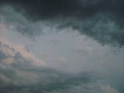
Anticlimatic
A good show of lightening and a fair amount of rain–it seems that’s all this storm will amount to. We’re headed back upstairs for what will hopefully be a quiet night once this line passes completely.
How did everyone else fair?
5 Jun
Basement blogging
Bryan has us camping out in the basement, so it’s hard to provide much of an update. I can hear thunder, but I can’t see a thing. So much for live weather blogging. Radar seems to show the storm slowing a bit, and the live images we’re seeing on TV show a pretty impressive shelf cloud.
5 Jun
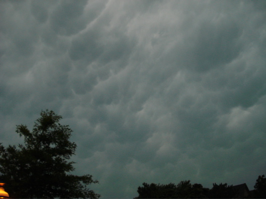
Bow echo
This line of storms has formed a bow echo–a curve like an archer’s bow–due to the winds behind the storm. A bow echo usually means significant wind damage and is often associated with tornadoes.
5 Jun
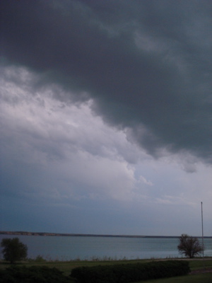
Getting closer
The evening’s first line of thunderstorms is about 15 minutes away.
You can see how storms–even a line as strong as this one–wraps itself around large lakes. Check out the area just to the west of Leavenworth. I wonder if the same thing will happen in our area. Time will tell!
Here are a few shots I took about 10 minutes ago.

The temperature has dropped about 15 degrees, I’d guess. The wind is still–always–blowing.


5 Jun
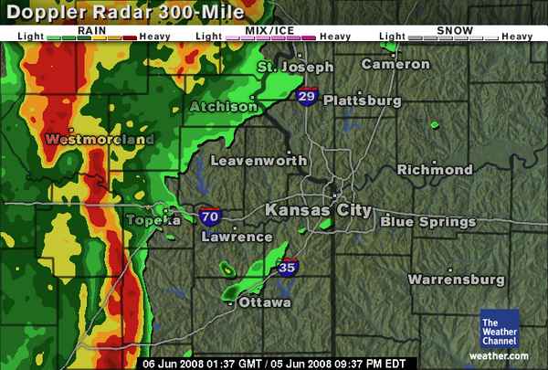
More weather warnings
This map is from an interesting weather blog at a Kansas City NBC affiliate. It still sounds like we’re in for some serious storms, and it will be fascinating to see how they develop.
It’s not quite 90 degrees yet today, but it’s very overcast and extremely humid. It’s also windy, but the wind seems to blow 20 miles an hour here no matter the weather.
There’s part of me that wishes I was headed a bit south and west to watch!
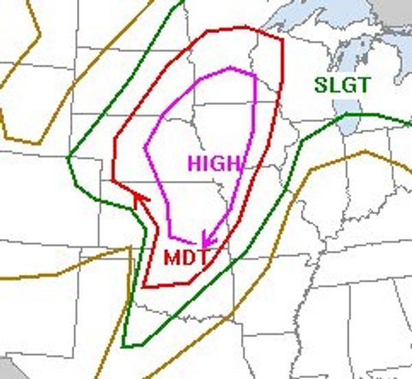
4 Jun
Bracing ourselves

Forecasters predict tornado outbreak on Thursday
Associated Press – June 4, 2008 11:14 AM ET
WICHITA, Kan. (AP) – The National Weather Service warns of a possible tornado outbreak in the Great Plains tomorrow with conditions similar to a deadly day in 1974 when 39 tornadoes touched down.
Computer forecasting models resemble those on June 8, 1974, when more than three dozen tornadoes touched down in the southern Plains and killed 22 people, including six in Emporia.
NWS meteorologist Robb Lawson said “this event warrants more advance warning.”
The National Oceanic and Atmospheric Administration’s Storm Prediction Center has been warning for days of the outbreak.
Mike Smith is CEO of WeatherData, a subsidiary of AccuWeather. He says some forecasters are predicting the tornadoes could hit a corridor stretching from northern Oklahoma to central Iowa. That area would include much of Kansas and northwest Missouri.
Smith said, “If you take April dynamics and June thermodynamics, you have a potentially disastrous combination.”
___________________________
We’ve seen some incredible weather this spring–just what you’d expect in Kansas. Last night I returned from from a three-day trip to Austin, Texas. On the way home, the sky was filled with cloud-to-ground lightening strikes. I even saw a wall cloud, which prompted me (and about three other cars) to pull over and watch for a bit. (It was uneventful–no rotation.)
I’m a bit nervous given the predictions for tomorrow, but usually advance warnings like these ensure that we won’t get as much as a raindrop. I’m also consoled by the fact that Ava’s new preschool was hit by a tornado several years ago, and we all know they never strike the same place twice. Right? Or is that lightening?
It’s going to be a long day. Keep an eye on the skies, my fellow Midwesterners.
28 May
An Eye on the Sky
The weekend trip to south central Nebraska was punctuated by a few great thunderstorms. There’s something about the way they form around the lake–it’s just breathtaking!